Charles Darwin/Second Voyage Around the World (2005-2009) Step Chile Peru' Galapagos (summary)
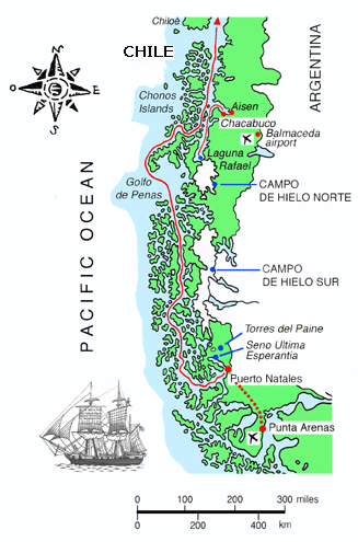
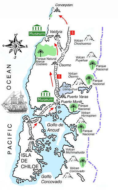
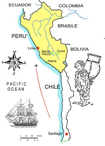
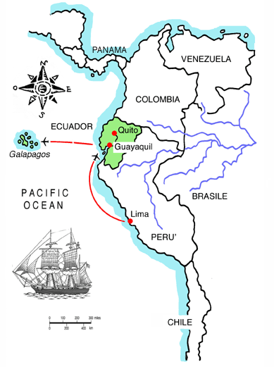
Darwin's Second Voyage goes on. It began in October 2005. After Cabo Verde, Rio and the Atlantic coast , January 10, 2007 Darwin2 Mission starts from Punta Arenas, in the Strait of Magellan. We will sail up the Pacific Coast to the Galapagos Islands.
1.Strait of Magellan "In the end of May, 1834, we entered for a second time the eastern mouth of the Strait of Magellan. The country on both sides of this part of the Strait consists of nearly level plains, like those of Patagonia".
"June 1st. -- We anchored in the fine bay of Port Famine". Charles Darwin, The voyage of the Beagle, 1839
2. Pacific Coast
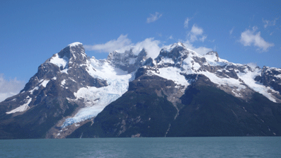
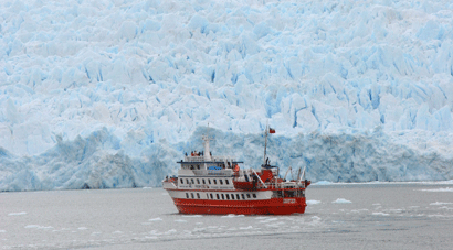
"Almost every arm of the sea, which penetrates to the interior higher chain, not only in Tierra del Fuego, but on the coast for 650 miles northwards, is terminated by "tremendous and astonishing glaciers," as described by one of the officers on the survey. Great masses of ice frequently fall from these icy cliffs, and the crash reverberates like the broadside of a man-of-war through the lonely channels. These falls, as noticed in the last chapter, produce great waves which break on the adjoining coasts".
"In Eyre's Sound, in the latitude of Paris, there are immense glaciers, and yet the loftiest neighbouring mountain is only 6200 feet high. In this Sound, about fifty icebergs were seen at one time floating outwards, and one of them must have been at least 168 feet in total height".
3. Chiloè island "On the 21st we anchored in the bay of S. Carlos, the capital of Chiloe. This island is about ninety miles long, with a breadth of rather less than thirty. The land is hilly, but not mountainous, and is covered by one great forest, except where a few green patches have been cleared round the thatched cottages. From a distance the view somewhat resembles that of Tierra del Fuego; but the woods, when seen nearer, are incomparably more beautiful. Many kinds of fine evergreen trees, and plants with a tropical character, here take the place of the gloomy beech of the southern shores. In winter the climate is detestable, and in summer it is only a little better".
The old church of Castro when Charles Darwin arrived in Chiloè in 1834 - The church today and Luca Novelli at the entrance of the Estacion Biologica, Darwin2 January 23, 2007
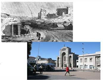
4. Remenbering the tsunami in Concepcion "We entered the harbour of Concepcion. While the ship was beating up to the anchorage, I landed on the island of Quiriquina. The mayor-domo of the estate quickly rode down to tell me the terrible news of the great earthquake of the 20th: -- That not a house in Concepcion or Talcahuano (the port) was standing; that seventy villages were destroyed; and that a great wave had almost washed away the ruins of Talcahuano." March 4th. - 1834
Ruins in Conception drawed by a Beagle officer. The main square in Concepcion, Darwin2, January 25, 2007 5. Walking in Santiago "On the 11th we anchored at Valparaiso, and two days afterwards I set out to cross the Cordillera. I proceeded to Santiago, where Mr. Caldcleugh most kindly assisted me in every possible way in making the little preparations which were necessary..."
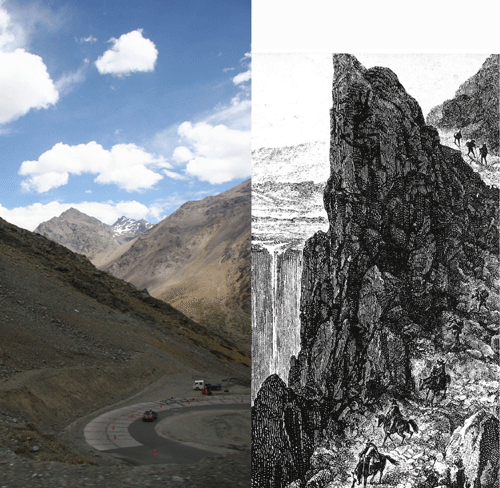
New town center in Santiago (Darwin2, January 28,2007) - Plaza de la Independencia, about 1830, from the Atlas de la Historia fisica y politica de Chile, by Claudio Gay 6. Across Andes to Mendoza "In this part of Chile there are two passes across the Andes to Mendoza: the one most commonly used, namely, that of Aconcagua or Uspallata -- is situated some way to the north; the other, called the Portillo, is to the south, and nearer, but more lofty and dangerous".
Paso del Portillo, Darwin2, January 29-30, 2007 7. Mount Campana "The mayor-domo of the Hacienda was good enough to give me a guide and fresh horses; and in the morning we set out to ascend the Campana, or Bell Mountain, which is 6400 feet high. The paths were very bad, but both the geology and scenery amply repaid the trouble". 16th August, 1834
Mount Campana National Park today, Darwin2, February 1st, 2007
8. Callao, Lima, Peru' "We anchored in the Bay of Callao, the seaport of Lima, the capital of Peru. We stayed here six weeks but from the troubled state of public affairs, I saw very little of the country. During our whole visit the climate was far from being so delightful, as it is generally represented. A dull heavy bank of clouds constantly hung over the land, so that during the first sixteen days I had only one view of the Cordillera behind Lima". Charles Darwin - 19th, July 1935
Darwin2 in Callao and Lima, February 3-6, 2007
9. Galapagos "This archipelago consists of ten principal islands, of which five exceed the others in size. They are situated under the Equator, and between five and six hundred miles westward of the coast of America. They are all formed of volcanic rocks; a few fragments of granite curiously glazed and altered by the heat, can hardly be considered as an exception..." Charles Darwin, 15th September 1835
|

